Wilks Fencing
Durfee Hills Interactive Map |
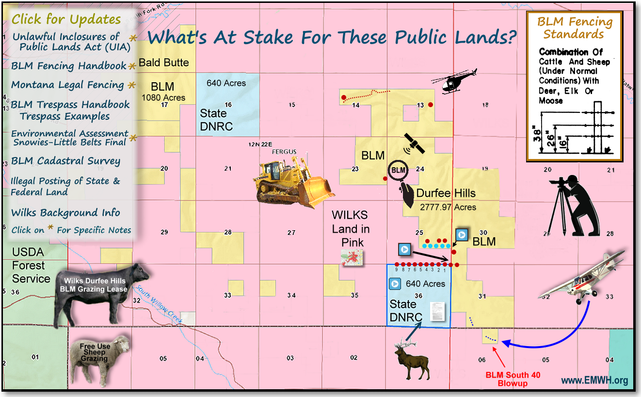
This
is a clickable interactive map
- click your mouse over text and images.
For example, click on the title, "Whats at stake for these public
lands" and you will see the issues involved with this fence and its
construction. Click on the  red dots to open pictures from those areas or the
  blue video icon for short videos. Additionally, images such as the plane,
bulldozer (not linked yet), fence diagram, Wilks land ownership or livestock
provide related documentation. When viewing a longer strip popup, hover
your mouse over the strip, you will see a + sign, click and it will enlarge
to full size with a scroll bar to the right. This
page is still under construction, adding more of the photographic
and videographic documention to the fence boundaries, so please
check back and refresh your page to get the current version. Map
created by Kathryn QannaYahu.
blue video icon for short videos. Additionally, images such as the plane,
bulldozer (not linked yet), fence diagram, Wilks land ownership or livestock
provide related documentation. When viewing a longer strip popup, hover
your mouse over the strip, you will see a + sign, click and it will enlarge
to full size with a scroll bar to the right. This
page is still under construction, adding more of the photographic
and videographic documention to the fence boundaries, so please
check back and refresh your page to get the current version. Map
created by Kathryn QannaYahu. |